Network design and assessment
We design seismic monitoring systems in accordance with customer needs—and we conduct this in three steps:
- Business requirement engineering
- from in-depth examination of original customer motivations to their transcription into microseismic objectives
- Geophysical modelling
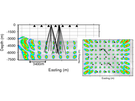
- simulation of wave propagation via our modelling software suite
- design of pertinent geometrical sensor network
- various scenarios are analysed and criteria-rated
- Front-End engineering design
- conception of a comprehensive, optimized monitoring system
- considering local deployment constrains
- identifying the appropriate equipment - software & hardware
- designing the system architecture in terms of communication and data flow

Decision support: Traffic Light System
We support customer needs by designing, setting up and operating traffic light systems (TLS).
Typically, real-time seismic monitoring will be used to operate a traffic-light warning protocol under which operations will be halted under predetermined conditions.
In case of threshold exceedance, audible and visual warnings are activated.
In parallel to the automatic processing, a qualified analyst is:
- Quality controlling the automatic processing results
- Reporting TLS status change and assessing the associated root causes
Advanced data processing
We perform advanced or exploratory processing techniques accounting for the context complexity, such as:
- Advanced detection for low Signal-to-Noise ratio microseismic events
- Advanced background noise analysis
- Advanced processing techniques for microseismic event characterization—picking multiple wave arrivals, double-difference, moment tensor inversion (MTI), discrete fracture network (DFN) modelling...

Velocity model calibration
We assess and update existing velocity models to improve location accuracy.
- Wide variety of models:
- From simple layered to 3D with complex interfaces
- Isotropic or anisotropic models (VTI, TTI)
- Q factor fixed or inferred during the inversion process
- Arbitrary network geometry (borehole, surface or hybrid)
- Calibration strategy tailored to available inputs, e.g. based on the reduction of:
- Relocation error of known sources (perforation shots, independently relocated strong events...)
- Post-location time/polarization residuals (misfits) on an arbitrary number of wave arrivals
- Possible joint inversion of velocity model and event locations
- Use of concurrent calibration processes to look for model families of similar performances and assess uncertainty on model parameters
Cross-data analysis
We study multi-faceted data to better understand asset behavior.
- Interpretation of site seismicity with respect to seismometers (existing local/regional/national networks)
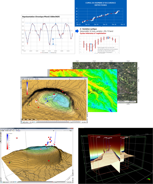
- Interpretation of site seismicity with respect to other data types (site production, geology, tectonics, petrophysics, geomechanics, statistical analysis, weather, subsidence, hydrologic)
- Seismological data mining (catalogue & probabilistic geo-processing)
- Analysis of seismic data along with contextual elements (e.g. existing faults) as well as production data if available


